


4-day challenge. 4 different massifs. 4 routes that will not overlap at any time.
On site, we found some obstacles in various places - it would take a long time to tell. Therefore, remember that GPX files are indicative, we follow the arrows. Sometimes we avoid logging, sometimes we avoid a swamp. We follow the arrows.
Unfortunately, Daleszyce will be modified and the Hard distance covers 2 Easy loops. There's heavy equipment on the road and it's really impassable. We leave the files, maybe in a month or two we will be able to drive there better.
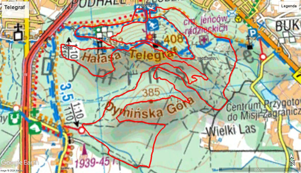
STAGE 1, Time Trial, Telegraf
Time trial, fighting with each other and the terrain. This is the first stage of the race, the stage that will set the sectors for the first mass start race.
We will start this stage at the starting station of the "Pod Telegrafem" lift. The competition office will be located next to it. We will indicate the exact point a few days before the start.
The route will end at the starting station or at the mountain (with instructions on where to go to the starting point).
The route is estimated to be 14 km long and 540 m vertical up.
The route will be the same for both distances. Competitors will start according to their arrival time.
The start and finish are located near Stok Telegraf
GPX file with the route.
STAGE 2, DALESZYCE
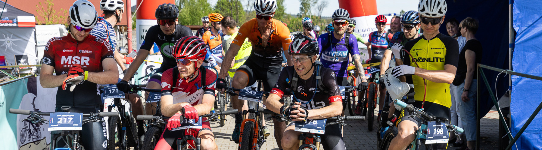
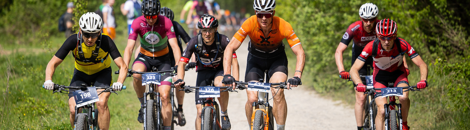
The first stage, where the competitors will face each other from a mass start, shoulder to shoulder, handlebar to handlebar.
The expected start of the competition, the competition office, will be near the community center in Niwy. It is about 2 km from Daleszyce. The route from this place leads immediately into the forest paths.
The competitors will cover a very large part of the Cisowsko-Orłowiński Park.
The route is estimated to be: 52km and 1500m of elevation gain.
The start of the stage is scheduled for 11:00 (Hard distance). 11:15-11:30 we expect the start of the Easy distance.The competition office should be open from approximately 9 a.m.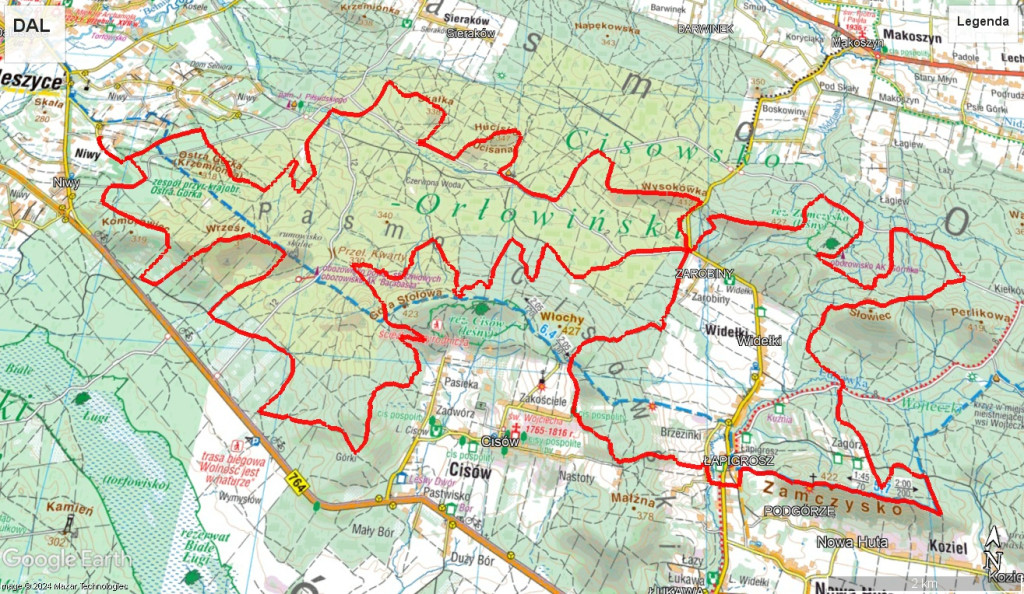
STAGE 3, NOWA SŁUPIA
In this stage, we will start from the school area in Jeleniów. As before, we will indicate the exact point on the map where to go.
We will check what the Jeleniowskie range looks like and we will also take a look at the Jeleniowskie Ścieżki.
The route is estimated to be: 51km and 1,900m of elevation gain.
The start of the stage is scheduled for 11:00 (Hard distance). 11:15-11:30 we expect the start of the Easy distance.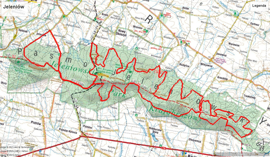
ETAPPE 4, NOWINY
The last stage, the Nowina stage. Here we plan to start near the school in Szewce.
The route will lead to the area of Jasniki Piekło and then to the Posłowickie range.
The route is estimated to be: 51km and 1550m of elevation gain.
The start of the stage is scheduled for 11:00 (Hard distance). 11:15-11:30 we expect the start of the Easy distance.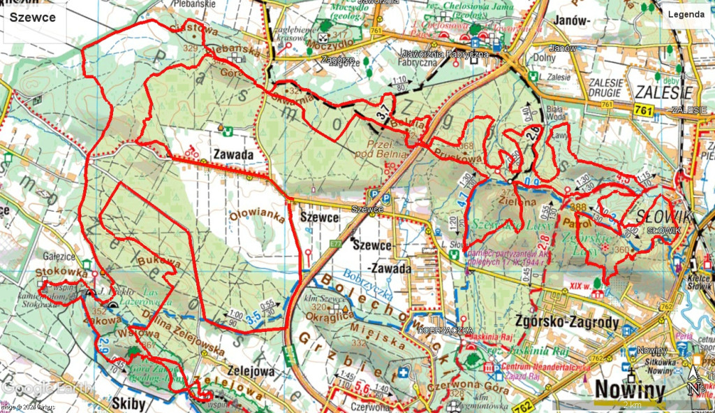
The starting order may still change.
Please remember that the route is an assumption at this point. Ultimately, there may be smaller or larger changes compared to the currently presented assumptions.
We try to make the route of moderate difficulty. What does "Moderate difficulty" mean to us? This is a route that an intermediate-advanced competitor will be able to complete at least 98%. In individual places, there are individual exits or driveways that you will have to pass, the rest should be possible to enter and exit. We want the experienced rider to feel the fun of riding, and at the same time, the less experienced one does not have to fear for his life every 500 meters.
In the case of a shorter route (Easy), a single major technical difficulty may occur on the route. We want the short route to be a great driving pleasure for less advanced competitors.


© 2023 - 2026 Baba Jaga MTB